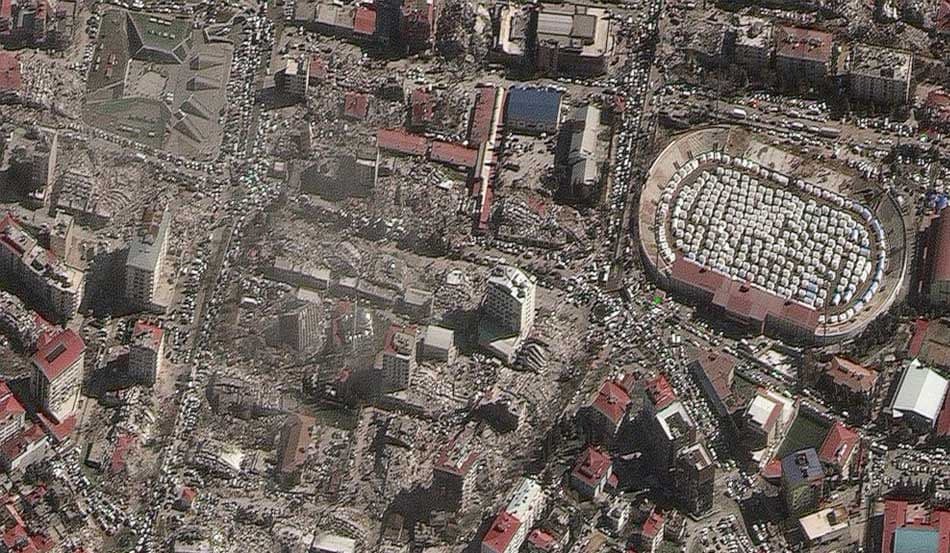

Government and defense agencies rely on Earth observation to monitor borders, protect critical infrastructure, and improve situational awareness. With high-resolution satellite and aerial imagery, teams can support GEOINT workflows, assess targets, and track activity across land and maritime domains in near real time.
LandEye brings together multi-sensor data—optical, SAR, and elevation—to help analysts detect change, measure impact, and coordinate emergency response. From defense mapping and surveillance to disaster impact analysis and public safety, imagery becomes a trusted layer in every decision.
Schedule satellites for your AOI
Explore providers' catalogs
COG, GeoTIFF, analytics-ready