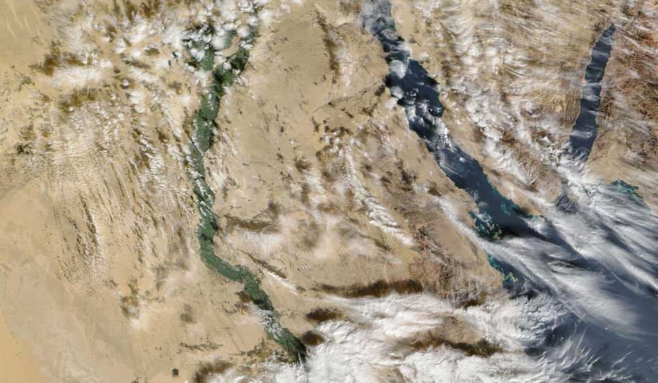
Captured on January 7, 2026, this satellite image provides a striking, wide-area view of Egypt and its surrounding regions, revealing the dynamic relationship between land, water, atmosphere, and human activity at the beginning of a new year.
Acquired by NASA’s Terra satellite using the MODIS sensor, the image combines true-color, corrected reflectance imagery with active fire detections. At a spatial resolution of 500 meters, it delivers a clear and objective overview of one of the world’s most historically and environmentally significant regions.

From space, the contrast is unmistakable. The fertile green corridor of the Nile River cuts through vast desert landscapes, highlighting the critical role of water in sustaining life across arid environments. The Nile Delta fans outward into the Mediterranean Sea, illustrating centuries of interaction between natural processes and human settlement. To the east, the Red Sea forms a sharp boundary between Africa and the Arabian Peninsula, emphasizing the region’s strategic and geographic importance.
Cloud formations drifting across the scene reflect active atmospheric conditions, reminding us that even in dry regions, weather systems play a constant role in shaping environmental patterns. Overlayed fire detections indicate active thermal anomalies, which may be linked to agricultural residue burning, land management practices, or localized vegetation fires. When combined with optical imagery, these data points offer valuable insight into surface activity that would be difficult to monitor consistently from the ground.
This image demonstrates the power of Earth observation to deliver large-scale situational awareness. In a single frame, satellite imagery supports environmental monitoring, climate analysis, disaster awareness, agricultural assessment, and land-use observation. It enables authorities, researchers, and organizations to move beyond fragmented ground reports and gain a comprehensive understanding of regional conditions.
As 2026 begins, this view of Egypt from space serves as a reminder of why satellite imagery matters. It provides timely, objective insight into a constantly changing planet and supports smarter decisions across environmental management, resource planning, and risk monitoring. Earth observation does not simply document the world—it helps us understand it.
Case studies with similar tags.
Articles with similar tags.

